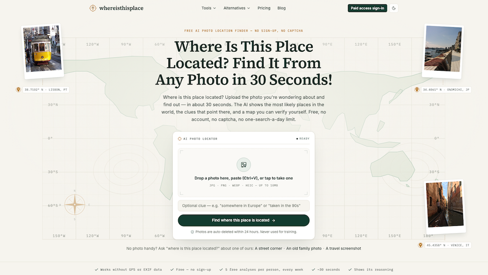
Where Is This Place Located? is a free AI-powered tool designed to identify the geographical location of any photo, even without GPS or EXIF data. Users can upload a photo and receive a location analysis within approximately 30 seconds, featuring the most likely places, visual clues, confidence levels, and a verifiable map. The service offers up to 5 free analyses per week without requiring sign-up or CAPTCHA.
The tool employs a sophisticated 6-step pipeline. Initially, it performs an in-browser EXIF check to detect existing GPS data; if found, the exact location is provided instantly. If GPS data is absent or stripped, the AI proceeds to a "Clue scan," meticulously analyzing visible elements such as script and signage, road markings, architecture, vegetation, license plates, and terrain. This is followed by an "Evidence double-check" where a separate verification pass re-examines every cited clue against the image pixels, discarding any unsupported claims to ensure accuracy and transparency. Finally, it presents "Ranked candidates" – the top three most likely locations with calibrated confidence levels, including an "not enough evidence" response when data is insufficient. A "Conclusion map" displays the source photo alongside an OSM/CARTO map, indicating precision (city, district, or street-level). For paid users, a comprehensive report with the full clue list and source provenance is available.
The AI leverages eight distinct clue families to pinpoint locations:
- Signs & language: Identifying scripts and specific words (e.g., "Rua" vs. "Calle").
- Driving side & plates: Determining left- or right-hand traffic and analyzing license plate designs.
- Architecture & roofs: Recognizing regional building styles and materials (e.g., Azulejo tiles in Portugal).
- Vegetation & terrain: Identifying plant species and soil types (e.g., red laterite soil).
- Road markings & bollards: Analyzing line colors and bollard shapes, which are often country-specific.
- Utility poles & wires: Observing infrastructure designs (e.g., concrete poles with transformers in Japan/Korea).
- Sun & shadows: Inferring hemisphere and latitude from shadow direction and length.
- Storefronts & vehicles: Recognizing local taxi colors, chain stores, and vehicle types.
This methodology allows the tool to succeed where traditional reverse image searches like Google Lens fail, particularly for private photos, cropped screenshots, or images not indexed online. It also distinguishes itself from generative AI like ChatGPT by providing evidence-backed reasoning and admitting uncertainty.
Where Is This Place Located? caters to a diverse user base, including:
- Travelers: Discovering locations from screenshots or travel photos.
- Family historians: Identifying places in old family prints.
- Journalists and OSINT researchers: Verifying photo locations for accuracy.
- Geography-game players: Studying visual clues to improve their skills.
The service boasts an accuracy of 95% for correct country identification and 87% for correct city identification on its public 50-photo test set, which includes street scenes, landmarks, indoor shots, old photos, and non-Western locations, with GPS and EXIF data stripped. The platform prioritizes user privacy, automatically deleting uploaded photos within 24 hours and never using them for AI training. GPS metadata is processed locally in the browser, ensuring it never reaches the servers. The tool is designed to identify places, not people, and explicitly blocks attempts to track individuals.
The pricing model is flexible: basic analysis is free, while full evidence reports (including the complete clue list and best-supported map candidate) can be unlocked for a one-time fee of $3.99 or via a Plus subscription ($59.99/year or $16.99/month) which includes 50 unlocks per month.